Pointcloud and orthophotos of Spanish heritage. Digitise 2 KM real estate at lightning speed.
Quickly map 2 kilometres of historical sewers through the use of 3D laser scanners and orthophotos of the point cloud.
The city of Malaga wanted to have accurate documentation for the management and maintenance of a historic sewer and also more insight into the sewer's trace.
We were able to carry out this beautiful assignment for them.
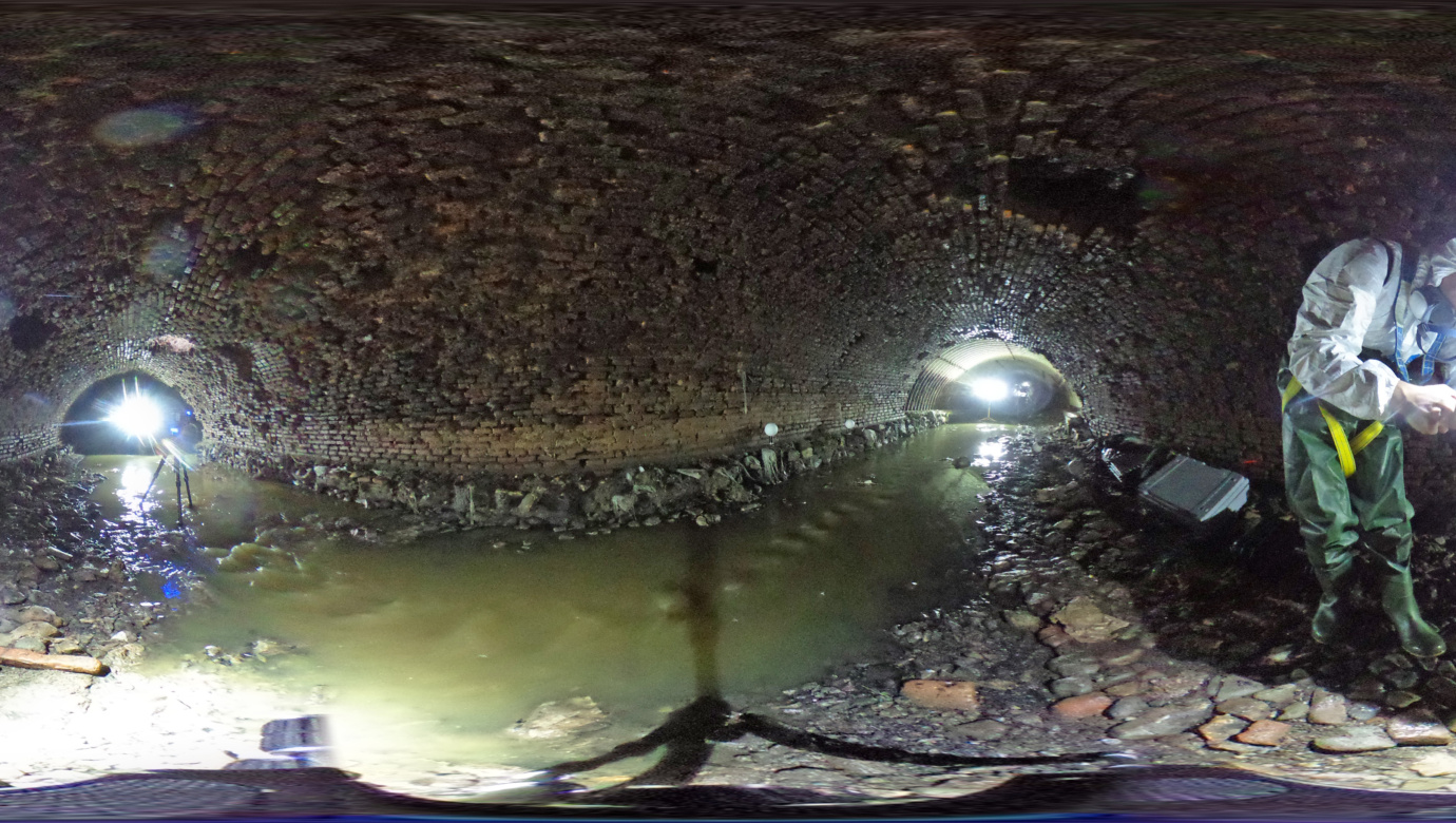
The construction of the sewer dates from the middle of the eighteenth century. The sewer runs partly underground under a number of buildings and rests on the foundations of a historic Moorish wall. This can truly be called a piece of heritage.
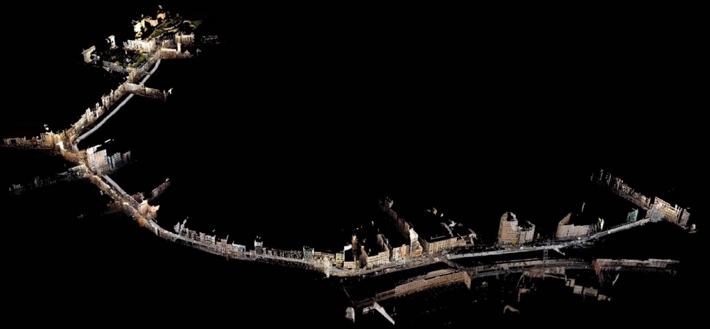
The entire route runs from Plaza de la Merced to the Alameda Principal and is only 2 kilometres long.
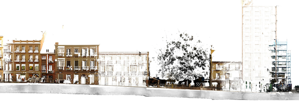
Below is an image of an orthophoto of a section of the street where the sewer runs underneath the buildings.
We have been able to fully map the sewer with 3D laser scanners as well as the above-ground part with high-resolution scans. Below is an impression of the sewer and our colleagues who are scanning.
Point cloud and orthophotos
With the point cloud, we have accurately mapped the process and the sewer itself. The client uses the point cloud as a talking point when planning and drawing up the renovation plans. Orthophotos can be used very well as a support for archaeology projects to make cross-sections. Making orthophotos from a point cloud is very fast.
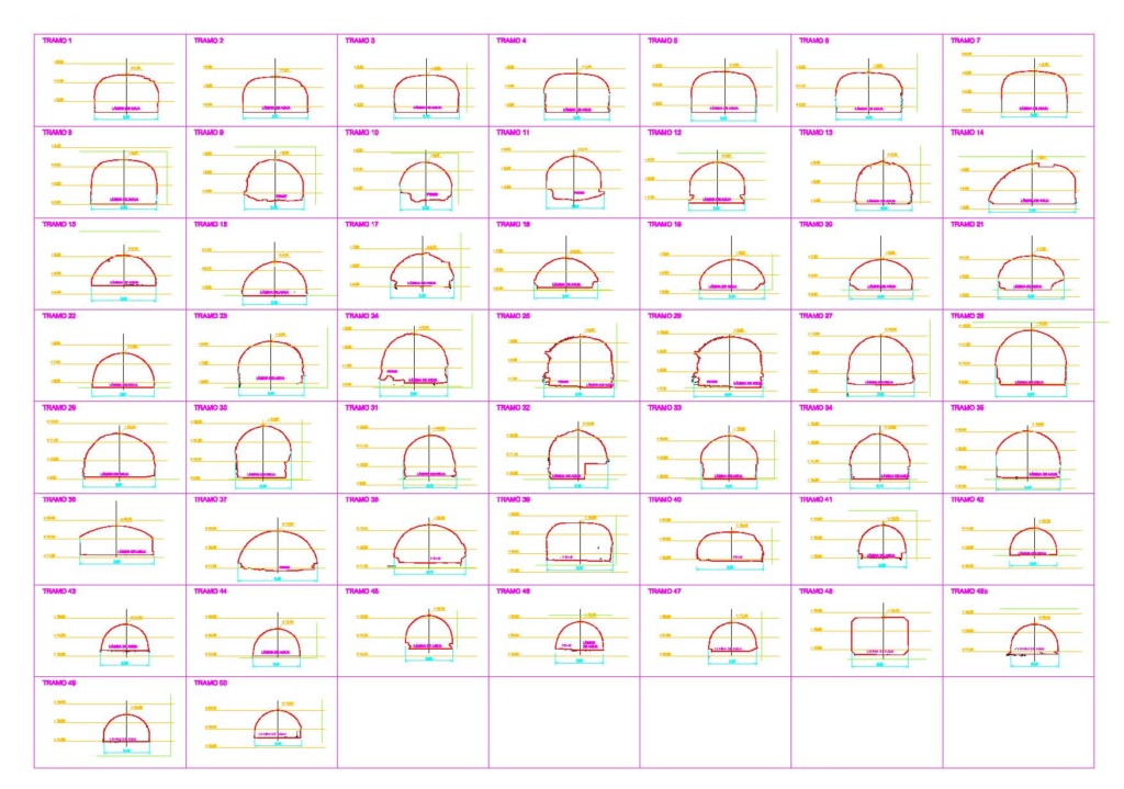
An orthophoto is a photo on a scale and can therefore be used perfectly as a base for or even instead of CAD/BIM drawings to scale. Would you also like to digitise a project or process? We are more than happy to talk to you.